
All you need to know about paddling in Argyll & the Isles
Scotland's Adventure CoastArgyll and the Isles is situated on the stunning west coast of Scotland. It is an area notable for numerous islands, large and small; high hills and mountains; and long deep glacially formed Lochs. These lochs cut the main area into a series of peninsulas resulting in a coastline reputedly longer than that of France. We think you'll go wild for it here!
An area to paddle like no other
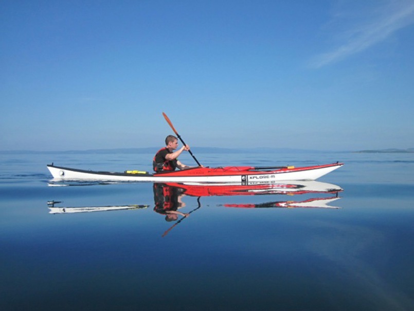
The population of 86,000 is thinly spread over the whole area, with most in small towns like Helensburgh, Oban and Campbelltown. The density is in fact the lowest in Scotland with Jura, for example, only boasting 196 inhabitants for its 36,692 hectares (132 square miles) Argyll is open to the North Atlantic to the west with spectacular seas in windy conditions and some world famous surf beaches. The large tides associated with the Atlantic also produce some dangerous tide races, notably the North Channel between Argyll and Northern Ireland, the world famous Corryvechan Whirlpools and the Falls of Lora. The ocean and the normal strong south westerly winds together also produce the worst part of the Argyll experience; the weather. As you will see from the photos in this guide, if the weather is kind it is the best, most varied area for paddlesports in the World. If unkind this guide will do its best to warn you of the dangers.
The other infamous feature of Argyll is the Scottish midge. In calm, warm, overcast evenings the midge will destroy your appreciation of the peace and beauty of the area. If you can only get to Scotland in July and August you are well advised to seek indoor accommodation or camp close to somewhere where there is some shelter from the hordes. Although the water is cold and the air temperature at night can be freezing (snow is not unknown), May and early June provide the greatest freedom from the midge and long nights.
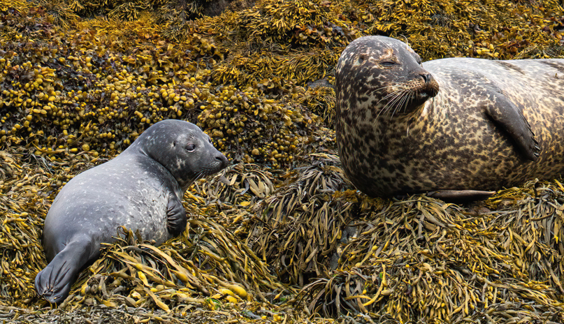
Finally, and importantly, Argyll has some of the most spectacular wildlife in Europe. To the East, on the islands of Loch Lomond, can be seen Ospreys, Wallabies and Roe and Fallow Deer. As you travel west you will become rather blasé about red deer, seals and porpoise but still get excited if a pod of dolphins cut across your bows. You will undoubtedly become just a little nervous if a 20 foot basking shark takes a close look at you or a whale (Minke or Orca) “blows” just ahead. Meanwhile, in the air you could well see Golden Eagles and the huge spectacular White Tailed Sea Eagle. Sea Otters are quite frequently seen but still generate a lot of interest.
Argyll’s Geography: Glaciation
The incredible scenery of Argyll is largely the product of ice. As the ice sheet retreated to the mountain tops, it left ribbons of ice that ran down to the unfrozen seas. These glaciers scooped out huge “U-Shaped” valleys which eventually formed the lochs. Often there was a rock blockage, known as the terminal moraine, whBich led to large areas of freshwater being captured in the valleys. In Argyll the obvious examples are Loch Lomond and Loch Awe. In time, gaps in the terminal moraine appeared and relatively short steep rivers appeared, like the river Awe.
In other cases the blockage to the sea has been eroded and even disappeared completely leaving a U shaped valley full of seawater; the classic sea loch. Excellent examples are Loch Etive in the north, Loch Feochan in the centre, Loch Tarbet (Kintyre) in the south, Loch Long to the east and Loch Tarbet (Jura) on the islands.
The weight of the ice cap had the effect of depressing the land mass. As it disappeared the land “bounced back” leaving original beaches raised significantly above the sea level. Raised beaches can be clearly seen at the south end of Kerrera or just south of Appin near Lismore.
Finally the sea loch with the narrow and often shallow entrance combined with tidal flows, produces another important feature for all paddlers; the tide race.
Argyll’s Geography: Tidal Flows
The gravitational pull of the moon causes large bodies of water to move north and south along the West Coast. Sometimes the huge water mass is constrained by the physical geography. The water speed then increases to allow the mass to get through the constriction. Moving from South to North the water is initially drawn between Kintyre and Ireland in the North Channel causing a significantly increased tidal flow. If this flow is opposed by strong winds the water surface becomes particularly agitated and dangerous.
After the North Channel the water mass is split to go round Islay, with some pushed up the main channel between Kintyre and the islands. This increasingly constrained water body finds fast outlets to the ocean at the Sound of Islay (Between Islay and Jura), the Corryvechan (between Jura and Scarba), the Grey Dog (between Scarba and Lunga),the Sound of Luing (Lunga and Luing), the Cuan Sound (Luing and Seil) and the Seil Sound (Seil and the mainland). The speed of the flow often exceeds that possible for a kayak wanting to go in the opposite direction, making knowledge of the tides essential.
As discussed earlier, fast moving water running up against strong winds will generate a very rough sea, certainly one that can capsize the unaware. When that water runs over an uneven bottom it too will generate turbulence. The violence of the whirlpools in the Corryvechan is the result of the fast stream running over a subterranean cliff and rock spikes. Even small whirlpools formed by minor obstructions can be quite disturbing to the paddler.
The final impact of the tide is particularly important at the mouth of long narrow lochs like Loch Etive, Loch Feochan and Loch a’ Chumhainn (Dervaig, Mull). These fill and empty with the tides and also have a natural water flow from lochs and rivers further upstream. The mouth of these lochs is constricted and the water runs over the legacy of the terminal moraine. The effect is that the lochs simply have to empty very quickly generating a very fast turbulent current. In the case of Loch Etive, the drop between loch and sea level generates something akin to a waterfall. The resulting turbulence is known as The Falls of Lora and, when tidal conditions are “right” it is a very popular playspot for white water paddlers.
The other impact is that the loch continues to empty for a considerable period (typically an hour) after the tide has turned. The water flow is then apparently in the “wrong direction”. Loch Feochan, for example, flows out for about 8 hours compared to flow inwards lasting only 4 hours. This guide hopefully provides the information necessary to ensure easy passage at the best times.


