Island Bikepacking Trails
Scotland's Bikepacking CoastArgyll’s islands, the Inner Hebrides and Bute, offer fantastic bikepacking filled with beautiful beaches, some of the world’s best distilleries, great gravel tracks and local food experiences.
Our Bikepacking Argyll’s Islands route combines using public transport with ScotRail’s Highland Explorer, relaxing ferry journeys and great cycling on the islands of Mull, Jura, Islay and Mull to an itinerary starting and finishing in the host city of the UCI Cycling World Championships in 2023 – Glasgow.
For new bikepackers and gravel cyclists Bikepacking Argyll’s Islands offers a wide range of accommodation and incentives to stop, while experienced cyclists will find plenty of opportunities to extend the route.
Wild About Argyll's Island Backpacking Adventures


Discover the Route
As guidance for planning your own adventures, we have dividied the route into eight day itineraries.
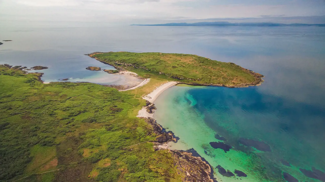
Craignure to Burg, Isle of Mull
Start in Glasgow, Train to Oban, Ferry to Craignure - Cycle to Burg
After taking the ferry from Oban to Craignure, the route starts at the ferry terminal, with a visitor information centre and public toilets, and a small shop for resupply opposite. The route follows the A849 out of the village, passing the golf course on the right. Immediately after the golf course a beautiful beach invites you to stop, and a standing stone can be spotted in the field on the opposite side of the road to the left. After Scallastle Bay the route takes a track on the right, which has recently been upgraded in stages and offers fantastic off-road cycling. It passes the Fishnish - Lochaline ferry terminal and for those wanting to extend the route, there are a number of additional trails in the forest.
Shortly afterwards the route follows a track on the left at Leiter, and rejoins the road again near a woodland. The well-graded gravel track is a nice alternative to the road, but beware of livestock (cattle) in the fields. The route passes Glenforsa airfield and continues into Salen. The small village offers places to eat and a small shop. A small detour to the Old Salen Pier offers stunning views over Salen Bay and a campsite.
From Salen the route continues on the B8035 towards Gruline. If you are interested in history, you can visit the Macquarie Mausoleum on a short detour (signposted). The B8035 continues along the shores of Loch na Keal, with outstanding views towards the mountains and the sea. A steep climb takes you away from the coast. Once the highest point is reached, follow a gravel track that branches off to the right down Gleann Seilisteir.
From Tiroran the route follows a farm track into Burg. The track ends at Burg Bothy, which is under ownership of the National Trust for Scotland and reopens in 2023. Out of reach for bikes, MacCulloch’s fossil tree offers a worthwhile excursion by foot. Please check the tide before you set off, as some sections of the coastal walk are only accessible at low tide.
Isle of Mull Coastal Route
Cycle to Craignure - Ferry to Oban
The route starts at Burg Bothy, under the ownership of the National Trust for Scotland. The wild coastline and MacCulloch’s fossil tree offers a worthwhile excursion by foot, but some coastal sections won’t be accessible at high tide.
From here the route follows a well-maintained double track to a car park, and from Tiroran continues on a singletrack tarmac road. The route joins the B8035 along the shores of Loch Scridain and further on to Loch Beg. From the road the views towards the mountains are stunning, and shortly afterwards a short section of gravel track connects the B8035 with the A849 through Glen More. Parts of the old road can be spotted on either side of the road, with some sections suitable for riding, while others offer you the finest bog you can find in Scotland.
Shortly after Torness the route continues on a track on the right, following the Lussa River downstream. This track meets the road at Strathcoil, from where the route continues on tarmac to the ferry terminal at Craignure. On this section of the ride you’ll find a number of out and back options to extend the route, including a visit to Duart Castle. Opposite Craignure Ferry Terminal are a visitor information centre and public toilets, as well as a small shop that is open all-year-round. There are also a number of seasonal eateries in the village, and a nice bunkhouse.
Oban to Tayvallich
Join National Cycle Route 78
Cycle to Tayvallich - Ferry to Craighouse - Cycle to Tarbert Bay
The route starts at the CalMac ferry terminal in Oban. Please push your bike along the first section on the footpath past the ferry terminal. The train station is to your right, from where the route follows the Caledonia Way out of town. This route contains sections on and outwidth the National Cycling Network, and is either signposted with the red 78 signs, or a black and white sign with the Caledonia Way symbol. The route climbs on Glencruitten Road out of town, and where after leaving the Caledonia Way descends towards Loch Nell. The route continues on this road until just before Kilmore, and then on towards Musdale.
The road climbs through the valley towards Musdale, and then follows a gravel track on the left eastbound towards Loch Nant. This remote section offers fantastic off-road riding, before an old asphalt road takes you to the shores of the loch and along its southern edge. Shortly afterwards the route follows a logging road to the right through a wind farm. Please take care here and make space for logging trucks if they approach. This ‘gravel highway’ offers great views over Loch Awe and the surrounding forests, before the track descends and joins the Kilmelford - Dalavich road. Dalavich is a great place to stop with a small cafe and shop.
From Dalavich the route follows the Caledonia Way, passing New York (yes!) to the left. Shortly after a parking area on the left the route continues on a gravel track first, and then joins a walking path amongst tall trees. If this is closed, please continue on the road. Otherwise the trail drops towards the coast and the route continues on a wider gravel track, which climbs steeply back towards the road. Once back on the road, the route continues on the Caledonia Way to Ford.
Follow the Caledonia Way to a parking space near the ruin of Carnassarie Castle, north of Kilmartin. This area spans 5,000 years with a multitude of cairns, standing stones, carved rock, stone circles, forts and castles and is considered to have one of the most important concentrations of Neolithic and Bronze Age remains in Scotland. While the path towards the castle ruin is steep and the ground here can get muddy at times, following this off-road section of the Caledonia Way is worth the effort. After Kilmartin the route continues on the road again across Moine Mhor. Depending on the wind direction, this super straight stretch of road can be challenging or enjoyable in equal measure.
The route leaves the Caledonia Way and follows the road along a short section of the Crinan Canal and the B8025 on to Tayvallich. For more gravel, please follow the forest road towards Leac Na Ban and around the peninsula. The Jura Passenger Ferry runs from Tayvallich to Craighouse on the Isle of Jura between the end of March and end of September. Please book your ticket in advance, bikes travel free. As an alternative you can also get to Jura with Venture West, which operates out of Crinan Harbour, and drops cyclists off at the northern end of the island.
Isle of Jura
Craighouse - Cycle to Tarbert Bay
From Craighouse the route continues through the village on the A846, also known as the Long Road. Expect much less traffic than on a usual A-road and a few more potholes. Friendly deer line the road at times. The route continues past a beautiful bay to Lagg, where it climbs steeply into a woodland, and descends to the thinnest part of the island at Tarbert. You can find a standing stone and the remains of a chapel in the field at Tarbert Bay, and a gravel track to the left leads down to Loch Tarbert.
Islay to Jura
Cycle from Feolin Ferry to Port Askaig
The route starts at the boat house on the shores of Loch Tarbert, where once drovers landed their cattle and transferred across the gravel track to Tarbert Bay, to continue their journey to the mainland. The remains of a small chapel and a standing stone invite more exploring there, before the route follows the Long Road (A846) to Craighouse. After Lagg the iconic Paps of Jura come into sight, and there are beautiful sandy beaches just to the north of Craighouse.
Craighouse is a great place to linger for a while, with a cafe, hotel, the Jura Distillery (free samples) and a community shop. From here the route continues on the Long Road around the southern tip of Jura to Feolin Ferry. The Ferry House is the only dwelling at Feolin. The route turns right here, from where a great gravel road with a few small river fords leads into the Inver Estate. As the gravel road undulates towards Inver Cottage, it offers great views on the rugged coast of Jura and over to Islay, where a few distilleries are visible on the other side.
Where the gravel track leaves the coast, it passes through a short stretch of Atlantic woodland, the only of its kind on Jura. Climbing on a very smooth gravel track out of the woodland, the Paps of Jura dominate the view once again. The route passes Cnocbreac next. Once a small settlement, nowadays there is nothing left that indicates people living here. As stated on a sign on the estate, many islanders have connections to Cnocbreac and as the population of Jura halved through the time of the Highland clearances, some evictions took place here, but not on the scale as other places experienced. There’s a loch to the left, which is a short detour off the route.
From Cnocbreac the track gets rougher, and gradually climbs north. The views across the Sound of Islay on a clear day are stunning, with Colonsay and Oronsay visible in the distance. Both golden and white-tailed sea eagles can be found on the island, and there is an abundance of red deer which roam the countryside. Another track branches off to the left where the route turns inland and begins to climb steeper on the rocky track. The riding here becomes more technical, but most of the route is rideable on a gravel bike. Some sections might require pushing, depending on the riding ability and track conditions.
After another short section parallel to the coast the track takes a 90-degree turn to the right, and this is where the steepest part of the route begins. Beinn an Oir dominates the view to the left, and Beinn a’ Chaolais towers on the right of the track. On a clear day. make sure to stop to soak up the views in all directions from here. From where another track branches off to the left, the going gets really tough. Good bike handling skills are needed while bouncing over chunkier rocks. Where the route fords the Allt an t-Sluic Bhrodaich, it turns south. After another 1.5 kilometres you reach the route’s highest point at 261m. While the riding on the rough track is still demanding, it’s all downhill from here to Inver Cottage.
From Lochan Gleann Astaile a very smooth gravel ‘highway’ leads down to the coast. The existing lochan was raised to become storage for a large hydropower scheme, one of the largest privately owned hydropower schemes in the UK. You’ll notice the difference in riding compared to the rougher estate tracks. From Cnocbreac the route follows the same route back to the ferry terminal in Feolin, with frequent connections to Port Askaig on Islay. Information on timetable and fares can be found at Argyll and Bute Council website.
Port Askaig - Port Ellen - Port Charlotte
The route starts at Port Askaig, where the ferry from Jura and Calmac ferries from Kennacraig and Oban arrive. The first 14% climb on the road will warm you up, looking back is recommended, as the views are amazing. The route takes a small track through a gate on the right, which leads to a loch. The track becomes wider here and takes you through a beautiful woodland on a wide track and past another, bigger loch. Shortly after the loch the route joins the tarmac again on Glen Road.
The route follows Glen Road south, past the wonderfully rugged hills on Islay’s eastern coast. While it is tempting to try some of the gravel tracks that leave the road to the left, sooner or later they’ll end in a deep bog. The route follows Glen Road and then meets High Road into Port Ellen. From here the route follows Lennox Street out of town and a cycle path to three distilleries - Laphroig, Lagavulin, and Ardbeg. You could easily spend a day visiting and enjoying the pretty coastline, but once the route returns the same way, it passes Port Ellen and takes a left at the end of the town/village.
A singletrail on the left takes you through another beautiful woodland and onto a beach and on a wider track back to the road. From here the route continues on a short section of gravel on the right to connect with the main road to Bowmore. This is flat and enjoyable, but be mindful of passing traffic. As an alternative for those with wide tyres and loads of time, try the beach all the way up to Bowmore.
Past Bowmore the route continues all the way to Bruichladdich on road, and on a final section of segregated cycle path to Port Charlotte, where the hostel offers a great choice to stay for cyclists, and pizzas and ice cream to purchase for late arrivals without food.
Cycle Islay
Cycle from Port Charlotte to Port Askaig
The route starts at Port Charlotte Hostel and follows School Street west out of town, with a nice climb to warm up the legs. After a farm on the right a gravel track climbs gently north After passing a gate the track gets rougher, while it climbs towards steep cliffs and then descends towards Machir Bay. This is one of the most stunning bays/beaches on Islay, so bring time. There is livestock in the fields the track passes, at times a detour is necessary to avoid cows with calves.
After Machir Bay the route joins a small tarmac road to loop around Loch Gorm, before returning to the coast. The alternative to the loop around the loch is to continue straight past Kilchoman Distillery. There is a short section on gravel before joining the road, and shortly before Bridgend the route follows tracks to rejoin the road after the village. In wet conditions staying on the road is advised.
As an alternative a small path runs parallel on the right side of the road too. Shortly after Ballygrant the route follows a small road signposted to Finlaggan, one of the most significant historic sites in Argyll. Shortly afterwards the tarmac turns into gravel, and once you enter the woodland, things get muddy. It’s worth enduring the muddy track, as soon after the woodland the gravel track offers great views to Colonsay & Jura. From Bunnahabhain the route follows the road for a while, and connects through another short section with the road to Caol Ila, and then returns to Port Askaig.
Kennacraig to Tarbert
Ferry from Port Askaig to Kennacraig and cycle to Tarbert
This route takes you from the ferry terminal in Kennacraig to Tarbert. There are no services at Kennacraig. Leave the ferry terminal on the road to the left and follow the road until a campsite on the right. This road can get busy, so extra care is needed here. From the campsite a gravel track/road climbs gradually uphill. Once at the top, take the first track on the left, which can be steep and technical at times. Passing the remains of Tarbert Castle the route descends into the small fishing village and continues on the road to the ferry terminal.
Portavadie, Colintraive to Rhubodach
Ferry to Portavadie - Cycle to Colintravie - Ferry to Rhubodach - Cycle to Rothesay
From the ferry stop in Portavadie follows Sustrans Route 75 towards Millhouse. A short but fun detour on the Cowal Way from here is recommended, before Route 75 is joined again from Kames into Tignabruaich. This small village offers good places to stop, before the route continues to follow the Sustrans Route around the bay, following Argyll’s Secret Coast. As tempting as it seems, taking the Cowal Way along the shore is not recommended at all, as it is unsuitable for bikes. The route continues on NCN75 until shortly after Stronafian, where it leaves the Sustrans route to follow the road towards Colintraive. There is a short section where the route diverts from the main road. Scotland’s shortest ferry journey takes you to Rhubodach on Bute, where the next section starts.
North Bute
Scotland’s shortest ferry journey takes you to Rhubodach on Bute, from where the road leads south along the shore. Just before Port Bannatyne follow the road on the right. Shortly afterwards the route follows the line of an old Tramway on a multi-user path to Ettrick Bay. A nice flowy trail follows the bay south and then connects with the road. Continue on the road (A844) south and then eastbound. At a fork continue straight onto the B878, which heads to Rothesay. In Rothesay the route passes the castle and ends at the ferry terminal.
Rothesay Loop
Cycle a circular tour of the Isle of Bute
This route is a great off-road tour of the Isle of Bute. It starts at the ferry terminal, and follows the High Street towards Serpentine Road, one of the most iconic road climbs in Scotland. After the serpentines the route follows a track on the left into a woodland, and rejoins Eastlands Road down to the shore. The route follows the road along the shore to Ascog, where seals often bask in the sunshine on the nearby rocks.
Continue on Mount Stuart Road and follow the signs to the house, which is one of the many highlights on this route. The route takes you past the house, and out of the grounds onto Bruchaig Road. Shortly afterwards the route joins a gravel track on the left, which meets the road again near Manse, and continues on to Kingarth.
The route follows the road along Kingarth Bay and then follows a path to the right at the edge of a woodland to connect with Plan Road. At a T-junction take a left and continue on the road for a while, until a gravel track branches off on the right. This beautiful track takes you along open moorland and joins the B881 back towards Rothesay. The route passes the serpentines again and finishes at the ferry terminal.
Bute to Glasgow
Wemyss Bay - Cycle to Gourock - Train to Glasgow
This short section starts at Wemyss Bay ferry terminal. Greenock Road is followed through the town, before the route joins Sustrans Route 753 along the coast, which is traffic-free. After a while the route follows the road again, with a segregated cycle route most of the way. Greenock is a good starting place for new adventures, either by catching the ferry to Dunoon and joining the Wild About Argyll Trail or by taking the train to Glasgow/Helensburgh - to join the John Muir Way or the many other Sustrans routes from there.

Ready-Made Argyll Komoot Routes
We have over 70 tours mapped out and ready for you to download via Komoot for your next cycling adventure.

Explore all the places to visit in Argyll & the Isles
3700km of coastline, 23 inhabited islands, major towns and villages are all waiting for you.